


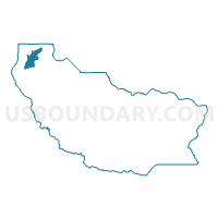
Water: Carr Inlet, Pierce County, Washington
About
Outline

Summary
| Unique Area Identifier | 688168 |
| Name | Water: Carr Inlet |
| County | Pierce County |
| State | Washington |
| Area (square miles) | 16.81 |
| Land Area (square miles) | 0.00 |
| Water Area (square miles) | 16.81 |
| % of Land Area | 0.00 |
| % of Water Area | 100.00 |
| Latitude of the Internal Point | 47.32730770 |
| Longtitude of the Internal Point | -122.69609000 |
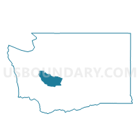
Maps

Graphs
Select a template below for downloading or customizing gragh for Water: Carr Inlet, Pierce County, Washington


Neighbors
Neighoring Voting District (by Name) Neighboring Voting District on the Map
- Voting District 26-204, Pierce County, WA
- Voting District 26-212, Pierce County, WA
- Voting District 26-213, Pierce County, WA
- Voting District 26-214, Pierce County, WA
- Voting District 26-217, Pierce County, WA
- Voting District 26-221, Pierce County, WA
- Voting District 26-223, Pierce County, WA
- Voting District 26-231, Pierce County, WA
- Water: Burley Lagoon, Pierce County, WA
- Water: Puget Sound Leg 26, Pierce County, WA
- Water: Van Geldern Cove, Pierce County, WA
Top 10 Neighboring County Subdivision (by Population) Neighboring County Subdivision on the Map
- Gig Harbor Peninsula CCD, Pierce County, WA (48,599)
- Key Peninsula-Anderson Island CCD, Pierce County, WA (15,595)
Top 10 Neighboring Place (by Population) Neighboring Place on the Map
- Artondale CDP, WA (12,653)
- Gig Harbor city, WA (7,126)
- Wauna CDP, WA (4,186)
- Rosedale CDP, WA (4,044)
- Key Center CDP, WA (3,692)
- Purdy CDP, WA (1,544)
- Home CDP, WA (1,377)
- Raft Island CDP, WA (459)
Top 10 Neighboring Unified School District (by Population) Neighboring Unified School District on the Map
Top 10 Neighboring State Legislative District Lower Chamber (by Population) Neighboring State Legislative District Lower Chamber on the Map
Top 10 Neighboring State Legislative District Upper Chamber (by Population) Neighboring State Legislative District Upper Chamber on the Map
Top 10 Neighboring 111th Congressional District (by Population) Neighboring 111th Congressional District on the Map
Top 10 Neighboring Census Tract (by Population) Neighboring Census Tract on the Map
- Census Tract 726.03, Pierce County, WA (6,462)
- Census Tract 725.04, Pierce County, WA (4,638)
- Census Tract 725.03, Pierce County, WA (4,186)
- Census Tract 724.05, Pierce County, WA (4,107)
- Census Tract 726.02, Pierce County, WA (3,898)